Enregistrez gratuitement cette image
en 800 pixels pour usage maquette
(click droit, Enregistrer l'image sous...)
|
|
Réf : T01844
Thème :
Terre vue de l'espace - Déserts - Dunes (200 images)
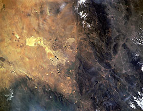
Titre : San Andreas Fault and San Gabriel Mountains, California, U.S.A. March 1994
Description : (La description de cette image n'existe qu'en anglais)
The San Andreas Fault is captured in this low-oblique photograph. A great fracture in the Earth’s crust and the principal fault in an intricate network of faults extending more than 600 miles (695 kilometers) from northwest California to the Gulf of California, San Andreas is the boundary of the North American Plate to the east and the Pacific Plate to the west. The Pacific Plate, moving northwest in relation to the North American Plate, causes numerous moderate-to-severe earthquakes. Visible west of the fault are the rugged San Gabriel Mountains, and still farther west is Los Angeles with the San Fernando Valley to its north. East of the San Andreas Fault are Rosamond Dry Lake and Rogers Dry Lake. To the northwest appear the Tehachapi Mountains.
|
|

